

Caravaning Kiwiland
 |
Seeing the South Island of New Zealand from the air is a bizarre way to start a road trip,
especially for someone who is afraid of heights.
By: Carrie Miller
“Get ready now,” shouts my tandem paragliding instructor, as we start running full tilt down the steep angle of Coronet Peak, dodging clumps of tussock grass and lichen-covered rocks.
“One . . . two . . . three,” he yells, and suddenly I’m running on air, the ground sucked away from my feet as we catch a thermal and soar into the sky. I’m hitched into a tandem harness that’s like sitting double on a swing, clutching the cords that rise to the brightly colored parachute arcing over our heads. The instructor controls our speed and direction; my job is simply to enjoy the ride.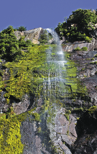
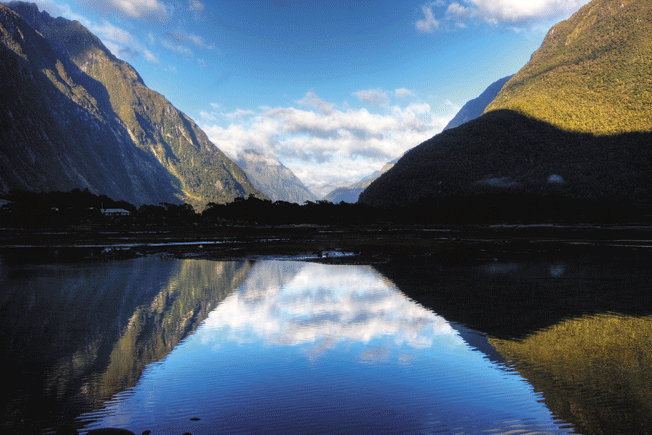
I open my eyes a fraction, and all fear is lost in the view. Clouds snag and tear on mountains (aptly named the Remarkables) that soar up around us in colors that seem lit from within: Yellows flare like molten gold, and greens glow like algae. In the distance, S-shaped Lake Wakatipu winds through the mountains, swept by mysterious tides. Maori legend tells of a great monster named Matau, whose beating heart causes the rising and falling of the water. Off to the right I can see Queenstown, the crown jewel of Lake Wakatipu and the beginning of our road trip.
Queenstown is a small resort town with elegant schist-paved streets and a mercurial energy that has earned it the title of Adventure Capital of the World. Bungee jumping, paragliding, Zorbing, white-water sledging, snowboarding, heli-hiking – every adrenaline-fueled sport I can think of – is on offer here, including a few I’ve never imagined.
Although soaring like a hawk is a great way to feel the enormity of the landscape, driving is still my favorite way to experience it.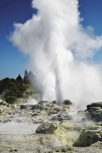
New Zealand unveils wave after wave of jaw-dropping landscapes, one moment serene and pastoral, with golden wheat fields and wide, braided rivers, the next surging with the upheaval of snow-capped mountains more than 10,000 feet tall, then splashing out in turquoise seas that would make the Caribbean envious. Every time you get behind the wheel the landscape changes. To really see New Zealand, you need the freedom to take that road less traveled.
I’m an American who has lived in New Zealand for the past five years. I met Liz Kevey (a Kiwi from Whangarei) in Wellington two years ago. She’s familiar with Christchurch, but she hasn’t explored much of the rest of the island, and so we planned a seven-day road trip through the heart of the South Island landscape: a crescent route starting from Queenstown, up the West Coast, climbing over remote Arthur’s Pass, to the East Coast, and doubling back to Christchurch, with its standout gardens and parks.
Our first day of driving starts on a high – a sugar high in Arrowtown, an old gold-mining town 13 miles northeast of Queenstown. Original 1860s gold-rush buildings rub shoulders with new cafes and art galleries on either side of tree-lined streets. In the Remarkable Sweet Shop, a cozy wood-paneled display on the main street, Liz and I stock up on old favorites like peppermint drops and blackballs, as well as new delicacies like kiwi-flavored fudge.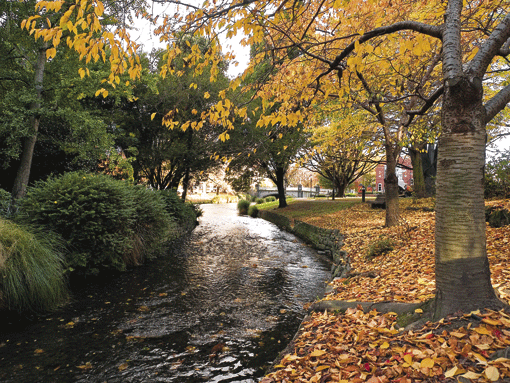
My mouth stuffed with peppermint drops, I ease our caravan off the shaded streets and onto New Zealand’s highest motorway, the Crown Range Road, a 43-mile ribbon of sealed road linking Queenstown and Wanaka. Pots and pans clatter around in the back of our caravan with each hairpin turn, but Carl (as we’ve named our motor home) proves dependable and easy to handle. It isn’t long before we’re descending back and forth over 11 crossings of the same stream, surrounded by burnished golden hills covered in puffs of tussock grass and occasional violent upheavals of rock.
“Stop!” Liz yells, and I pull over to the side in a spray of gravel. We nearly passed by the Cardrona Hotel – tiny, box-shaped and a Kiwi icon.
“The Cardrona is the hotel from the Speights beer commercials,” Liz says. “We grew up with them. Everyone has their favorite – kind of like your Super Bowl ads.”
Inside, a black cat lounges on a leather couch near the fireplace. A blackboard lists not the specials, but questions and answers about the hotel’s 146-year-old history. Outside, a stone fireplace rages with a warming fire in the grassy courtyard. The food portions are huge, the prices cheap. Liz and I tuck into bowls of sweet chili and kumera soup, washing it down with a handle of Speights.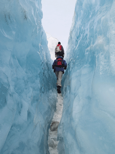
It’s only a 20-minute drive to Wanaka’s Aspiring Campervan Park. I pull out the camp chairs and prepare dinner, while Liz organizes the interior. Carl, a midsize caravan (minivan-esque in style), is cunningly designed: Two long bench seats double as a queen-size bed and storage for bedding and dishes. The back hatch hides a tiny kitchen, complete with sink, mini-fridge, and stove.
Within 20 minutes, we’re settled in for the night on the shoulders of Mount Aspiring National Park, eating dinner. Night comes on slowly. Lights begin to appear in caravan windows, and the murmur of laughter floats on the air. In these parks, there is company if you want it, solitude if you don’t, and there seems to be so much more time because everything you need is right at hand.
The next morning, a 90-minute drive takes us from Wanaka on a looping ribbon of road that winds between Lakes Wanaka and Hawea, past Fantail and Thunder Creek Falls, over Haast Pass, and into the enveloping rain forest. The rain forest marches to the very edges of the road, seemingly eager to reclaim it. The mountainsides are veined with white waterfalls, feeding rivers with colorful names like Roaring Swine and Gout Creek.
Driving in the South Island can be as much of an adventure as the adrenaline-laden activities of Queenstown. Although the island is under 100 miles across at its narrowest point, the 430-mile-long vertical spine of the Southern Alps can only be crossed by vehicle in three places (Haast Pass, Arthur’s Pass, and Lewis Pass), which means that a straight-line distance of 18 miles may take 310 miles of driving over one of the passes.
Liz and I are the only ones at Ship Creek, a small pull-off that’s the home of New Zealand’s tallest tree species, the white pine. A tannin-stained river empties from a swamp into the wild Tasman Sea. We follow the gravel and boardwalk trail into the swamp, and within minutes we are enclosed in a green curtain of fern and native rimu trees. A recent rain has flooded the river, and it isn’t long before the trail disappears under a dark layer of water. Liz and I keep hiking, blindly groping for the boardwalk with our bare feet, shoes slung over our shoulders, until the water rises past our knees. We clutch the ferns for support, conceding defeat.
What about New Zealand’s tallest trees? “I don’t need to see them,” Liz says. “I know they’re there.”
The tannin-colored river makes me thirsty for a cup of tea, and we brew one on Carl’s stove before driving the remaining 75 miles to Fox township, pulling in on a clear evening, the last rays of sun illuminating the snowy peak of 11,473-foot Mount Tasman, New Zealand’s second highest mountain,which borders Westland National Park.
There are more than 140 glaciers in Westland, and nearly two-thirds of the park’s glacial ice is contained in Franz Josef and Fox Glaciers.
“The difference between Fox and Franz Josef is better guides,” deadpans Richard Bottomley, our guide for the half-day Fox Glacier walk. “Fox is also bigger than Franz, more volume, but they’re brothers, like two rivers from the same valley.”
The glacier curves down between two mountains in a gleaming white tongue, ending abruptly in a towering terminal face of dirty ice and rocks. Fox and Franz Josef Glaciers are unusual in that they are surrounded by subtemperate rain forest and close to the ocean (Franz Josef is only 11 miles from the sea), which means that the glacier process happens in fast-forward here.
“Layers of snow are packed to create glacier ice,” Richard says. “This can happen in five to seven years here, which is quite fast. It can take up to 3,000 years in other parts of the world.”
Hiking along the glacier is like wading in a frozen ocean, with waves arcing and spiraling on either side and overhead. A recent rainfall (it rains about 200 days a year here) has cleaned and polished the ice into brilliant whites and cobalt blues.
Liz is a tactile tramper: On the glacier, she runs her hands along the diamond-hard blue ice and the gritty snow-cone ice that provides traction for our crampons. She also picks up a shin-length piece of fuselage.
“A plane crashed here in the 1970s and things are always popping up,” Richard says to us. “Due to the always shifting nature of the ice, what’s lost is always found sooner or later.”
From Fox it’s a two-hour drive to Hokitika, a former gold-rush town, now known for pounamu (hard nephrite jade called greenstone, used in tools, weapons and taonga – treasure). The town has a Wild West feel to it: Liz and I walk past colorful historic buildings, dilapidated houses, and artisan shops like Heritage Jade, New Zealand Ruby Rock, and the Hokitika Glass Studio. Most visitors come here for treasure or to watch the artisans work. We are looking for glowworms.
As soon as it grows dark, we grab flashlights and follow the highway to the outskirts of town. We catch a tiny placard in our beams: Glowworm Dell.
Glowworms are tiny insects that attract prey into sticky, single-strand webs through bioluminescence, a cool blue neon glow. They are often found in caves, but here in Hokitika they exist on a dark and quiet path, flanked by dripping ferns. We lower our flashlights and suddenly we’re surrounded by cities of electric blue lights, like star constellations fallen to Earth.
The next morning we have breakfast on the beach before tackling the two-hour drive to the remote outpost of Arthur’s Pass, at 2,428 feet, one of New Zealand’s highest settlements. Carl protests the steep incline as we inch inexorably up through bald mountains. I grip the wheel a little tighter when we drive under concrete bunkers designed to protect passing cars from falling rocks and avalanches.
The town of Arthur’s Pass (population 50) is the main settlement in a 282,935-acre national park of the same name, a landscape webbed with hiking trails, from 30-minute nature walks to serious backcountry tramps. Liz and I take the Otira Valley Track, a three-hour hike winding through snow-covered mountains, alpine scrub and bare, ankle-snapping rock to a swinging bridge. We rest on the bridge, kicking our heels and sharing an apple. The stream below is the vibrant color of blue antifreeze, dashing against car-size boulders. Once again there are no other souls in sight.
“You could lose yourself in a heartbeat here,” Liz says.
Leaving Arthur’s Pass the next morning, we follow a road that circles around the mountains like rings on Saturn, descending past limestone formations onto the Canterbury Plains. We wind our way into the half-moon harbor town of Akaroa, whipping around switchbacks that rattle our pots and pans.
Akaroa is famous for two things: It is the site of an 1840 attempt by France to claim New Zealand for her own (just a few weeks too late – the Maori had recently signed the Treaty of Waitangi, giving sovereignty to the British); and Hector’s dolphins, among the world’s smallest and rarest, and found only in New Zealand.
“These are very intelligent, very inquisitive little mammals,” says Hamish Crosbie, our guide with Black Cat Cruises. “When you get into the water, it’s totally up to you to entertain them. They have the whole Pacific Ocean to play in, so you need to give them a reason to come to you. Spin yourself in a circle, whistle in the water, but don’t splash – that’s a sign of aggression.”
“Hector’s dolphins make one area their home for life,” Hamish says. “Tourism helps – the more people who know about these little dolphins, the better their chances are of making it.”
It’s only a 50-mile drive back into Christchurch, where Liz and I end our trip by wandering through the famous Christchurch Botanic Gardens, savoring steaming cups of coffee on the banks of the Avon River, surrounded by walls of flowers in vivid pinks and rusty golds.
“Do you have this anywhere else in the world?” Liz asks me.
She is referring to the scenery in front of us, but she could just as well have meant our entire road trip.
“No, New Zealand is like nothing else,” I answer. I fell in love with the ever changing landscape the first time I set foot on these shores. My New Zealand “Travellers Road Atlas” is dog-eared from use and marked with red X’s for gems that I’ve found along the way. And my personal treasure map grows with new discoveries every time I get behind the wheel.